Distance to begin descent in NM for a 3° descent angle:
= altitude to lose/1000' × 3
More comfortable with a 2.4° descent angle?
= altitude to lose/1000' × 4
Descent gradient
= altitude to lose/1000' ÷ miles to go
Rate of Descent (for 3° glidepath)
= groundspeed × 5
Rate of Descent
= ETE ÷ altitude to lose/1000'
(What's neat about this method is the ETE from the FMS is accounting for winds, etc...)
The vertical path provided on the PFD and MFD is based on a default descent angle of 3.8°. A 3.8° descent should be roughly idle and 320kts. If you like a different descent angle you can set it here.
The vertical path provides guidance to the last fix before a discontinuity. If the last fix is a BETWEEN altitude restriction, it will aim for the top.
It also provides guidance to any AT fixes using 'path smoothing'.
The path is lastly evaluated for compliance to BETWEEN, AT OR ABOVE, and AT OR BELOW fixes and makes adjustments only as needed.
If there are multiple altitude restrictions, there might be multiple TOD points. However, if the descent angle from one restriction to the next is >1.0°,the vertical path is adjusted for a continuous descent, avoiding the need for a level off.
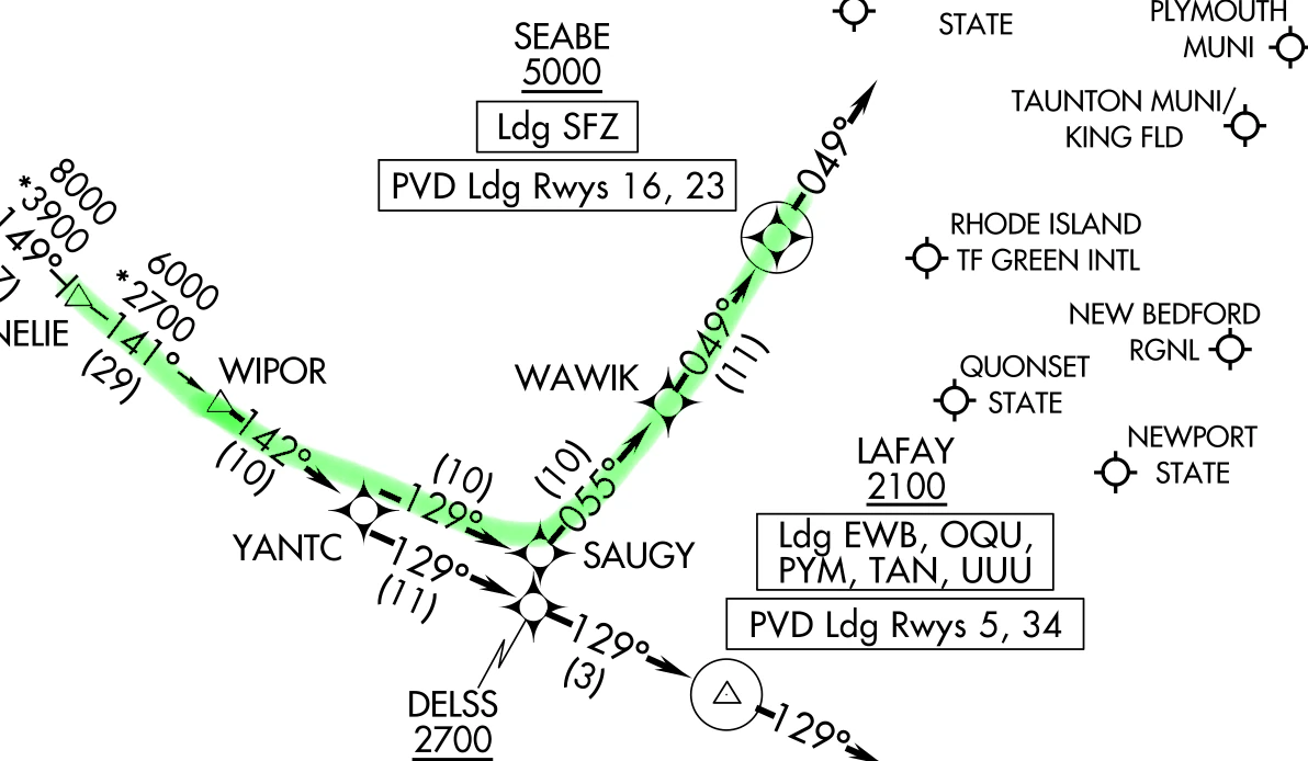
Consider the WIPOR4 arrival to KPVD, landing runway 16 or 23.
We are currently at cruise with a TOD and vertical path to SEABE. Typically the FMS does not create a vertical path to an AT OR ABOVE, except that this is the last fix before a discontinuity.
Now ATC instructs us to cross WIPOR at 11,000'. The FMS adjusts the TOD and vertical path for the new restriction. SEABE is 41.6NM track distance from WIPOR and 6,000' lower. The angle is 1.36°.
Normally, I let path smoothing do it's thing, but this is pretty shallow. I would rather stay above 10,000' at 320kts longer, so in this case I would adjust the vertical path angle to SEABE as 3.0°.
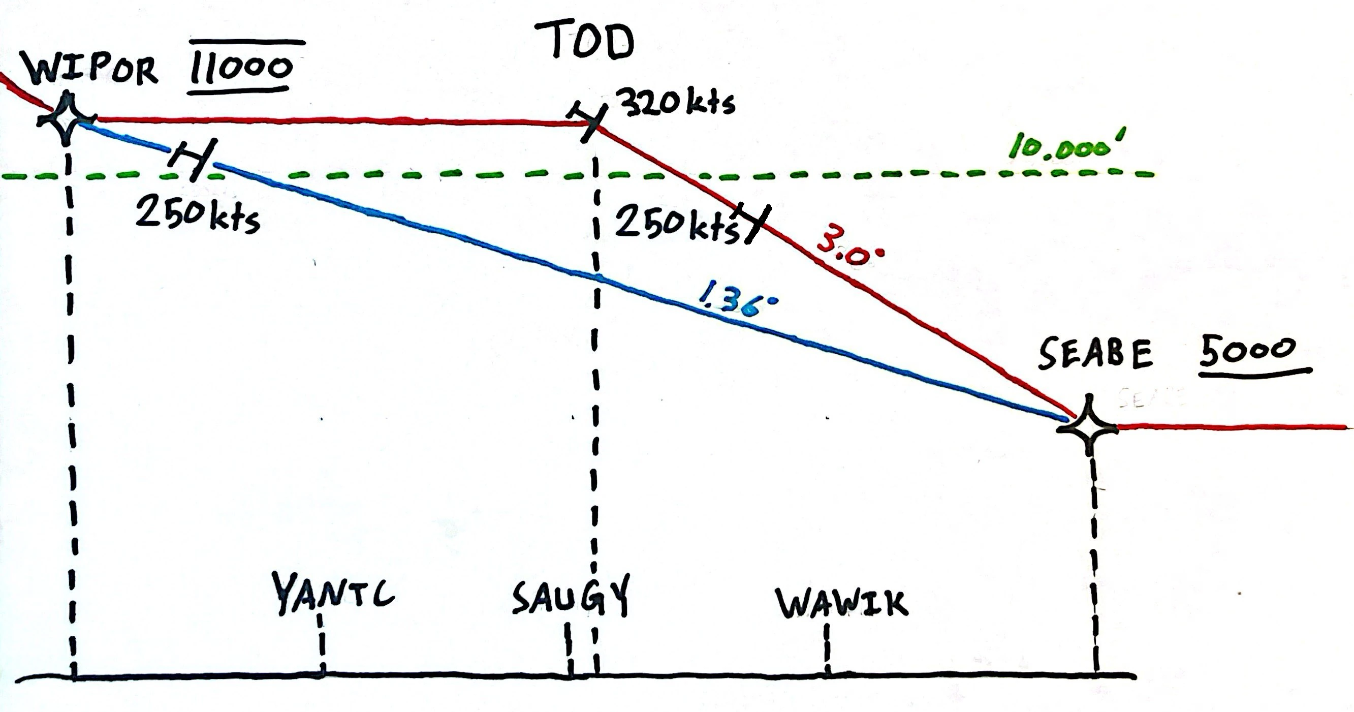
The lower method takes 8 and half minutes, the higher methods takes 7 and a half minutes.
While the FMS considers altitude constraints, it does not consider speed restrictions. If you strictly follow the FMS descent planning, you will be unable to slow down for many speed restrictions.
When advisory VNAV is selected the following items are displayed on the PFD:
The vertical deviation scale only shows if the vertical deviation is less than 1000' from the planned descent path.
The advisory pointer on the VSI only shows if the required descent rate is at least 500fpm and the top of descent at current altitude is within 50nm. It shows in the MFD as a number. Not shown for at or above constraints.
If close enough, the next alt constraint in the flightplan shows on the top right in green.
The top of descent (TOD) line shows when the distance to the TOD is less than 50NM or 20% of the total flightplan distance. The next descent altitude constraint and time and dist also show.
Top of Descent (TOD) point. The point where the planned cruise (or present altitude if different from cruise and within 50nm) intersects with the planned descent path.
Instead of changing the descent angle in the defaults, you can change it per leg segment here. This is also where a fix's altitude can be set.
The DIR INT page shows angle and descent rate to any fix that has a continuous route and ignores all intermediate constraints.
It also shows angles and descent rates to fixes after discontinuities, but it is unclear what these numbers mean. The handbook doesn't say exactly what distance is being used to calculate the descent angle. I've even tried the math on a few points but no obvious method seemed apparent.